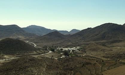
Localities in Cabo de Gata
Discover here all the localities in the Cabo de Gata-Nijar Natural Park and know in depth all the towns of this area of Almeria.
Nijar
The urban nucleus of Nijar is not inside the Natural Park, but it is still worth visiting.
It is a town of white houses where the Arabic Wells, the beautiful Church of Our Lady of the Incarnation, the old Market Square and the Atalaya neighborhood stand out.
It is one of the largest municipalities in Spain and in its municipal area there are several localities within the protection area of the Natural Park:
Nijar has been declared one of the most beautiful towns in Spain due to its picturesque urban planning of medieval origin, made up of white houses, narrow stone streets and facades permanently decorated with flowers.
In its natural environment, you can find mountains, desert landscapes and Mediterranean coasts, which gives it a unique diversity in the region. Its flora and fauna are also very rich, with a great variety of species found in its surroundings.
Tourism is the most developed economic activity in the municipality of Nijar, which is one of the favourite destinations of thousands of travellers from all over the world, who are drawn by its natural beauty, its pleasant climate and the many attractions found within the Cabo de Gata-Nijar Natural Park.
As for handicrafts, the jarapas are famous – a very colourful typical fabric of the region, with which rugs, blankets and bedspreads are made, using artisan looms.
Cabo de Gata Village

It is the nearest town to the capital, in fact this district belongs to the municipal district of Almeria.
This town has traditionally been dedicated to fishing, but nowadays it combines this activity with intensive agriculture and tourism.
Given its long fishing tradition, it is an ideal place to taste the fresh fish of the day in the bars and restaurants on its promenade.
This town has traditionally been dedicated to fishing, but nowadays it combines this activity with intensive agriculture and tourism.
Given its long fishing tradition, it is an ideal place to taste the fresh fish of the day in the bars and restaurants on its promenade.
This village began to be populated in the 18th century by fishermen who took advantage of the richness of the marine fauna of the place. In those days, it was a small village of humble seafarers surrounded by dunes, which gradually disappeared over time.
Its extensive beach is the main tourist attraction. Near it, there are several areas ready to camp in front of the sea and enjoy the spectacular sunsets.
La Almadraba de Monteleva
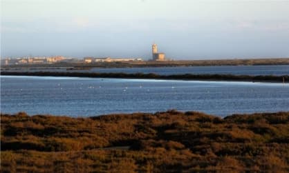
It is a small fishing village located around the beach of the same name, which grew in the early 20th century with the extraction and processing of salt in its saltworks.
Today it is a paradise for ornithological tourism and for lovers of photography. Hundreds of bird species use this unique ecosystem to pass the winter and rest in their migratory movements.
In this town is the recently restored Las Salinas Church, which is an iconic element of the Cabo de Gata.
Today it is a paradise for ornithological tourism and for lovers of photography. Hundreds of bird species use this unique ecosystem to pass the winter and rest in their migratory movements.
In this town is the recently restored Las Salinas Church, which is an iconic element of the Cabo de Gata.
San Jose
San Jose has its origin as a fishing village located in the bay of San Jose, between "Cerro En Medio" and "Cerro de la Higuera". Today, San Jose is considered the capital of the Natural Park, since it has the largest population in the Natural Park and has all the necessary services.
San Jose is surrounded by a unique environment and nearby you can find the most beautiful beaches and coves of the Natural Park, such as the Monsul Cove and the Genoveses Beach.
San Jose is surrounded by a unique environment and nearby you can find the most beautiful beaches and coves of the Natural Park, such as the Monsul Cove and the Genoveses Beach.
San Jose offers a variety of activities to those who visit it, such as excursions to nearby places of geological interest, with rock formations of volcanic origin rich in minerals of various types, photography tours, bird watching, diving and kayaking, windsurfing, horseback riding and bicycle riding, among others.
Pozo de los Frailes
It is a small village near the coast that is notable because of its small old town and a restored 14th century ferris wheel, known as the Blood Ferris Wheel.
It is very close to San Jose and has some beautiful landscapes and hills of volcanic origin with gentle slopes.
It has a typical architecture with orchards and cereal fields in its surroundings. A few kilometers away we find the neighboring town of Boca de los Frailes.
It is very close to San Jose and has some beautiful landscapes and hills of volcanic origin with gentle slopes.
It has a typical architecture with orchards and cereal fields in its surroundings. A few kilometers away we find the neighboring town of Boca de los Frailes.
This population is settled along the Rambla de Los Frailes and its inhabitants are distributed on both sides, extending towards the slopes of the nearby hills. Its former inhabitants dedicated themselves to agriculture and livestock, although these activities were declining with the rise of tourism.
Its old village centre is made up of typical buildings of Mediterranean architecture, with single-storey houses, rectangular and whitewashed.
Boca de los Frailes
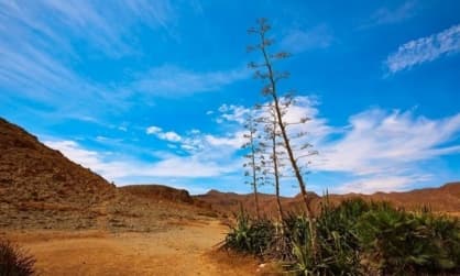
Boca de los Frailes is a tiny urban center with only about 50 inhabitants, better known as "Las Bocas".
It is 25 km from the city of Almeria and 4 km from the neighboring village of Pozo de los Frailes.
Its small urban nucleus and its Mediterranean style farmhouses are particulary appealing, in addition to its beautiful landscapes.
It is 25 km from the city of Almeria and 4 km from the neighboring village of Pozo de los Frailes.
Its small urban nucleus and its Mediterranean style farmhouses are particulary appealing, in addition to its beautiful landscapes.
Its name comes from the natural environment where it is located, a mouth or access to the sea between two hills, and on the other hand from the Dominican friars, former owners of these lands.
This locality served as a crossing point and confluence point for the abundant herds that grazed in the vicinity. Most of its streets are not paved, and in the vicinity of the village, you can see cisterns, an old windmill and other vestiges preserved from its agricultural-livestock past.
Boca de los Frailes is a village with a rural setting that maintains typical elements of the farmhouses that surrounded it, preserving the architectural elements and constructions of its remote past unchanged.
Los Escullos

It is a small and old fishing center located in the cove of the same name, under the "Cerro del Fraile"; a 490 meter volcanic dome.
In the surrounding area there is the Escullos Castle or Saint Philip Castle, which stands on a hill at the so called "Punta del Esparto".
The castle was restored in 1990 and in it we can enjoy various cultural events. It was declared as Asset of Cultural Interest in 1993.
In the surrounding area there is the Escullos Castle or Saint Philip Castle, which stands on a hill at the so called "Punta del Esparto".
The castle was restored in 1990 and in it we can enjoy various cultural events. It was declared as Asset of Cultural Interest in 1993.
In its vicinity is El Arco Beach, where you can practice multiple sports activities such as surfing and diving. The fossilized dune found on El Arco Beach is the largest in Europe. It is an impressive rock formation on the seashore. From there, you can see spectacular landscapes, making it an ideal place to take pictures. It is also a suitable place to practice mountain biking and hiking, with a free camping area facing the sea.
La Isleta del Moro Arraez
Formerly frequented by Arabs and Berber pirates in search of treasures, you can see two large rocks on its beach, one of which is slightly separated, as if it were a small island, which is how the town got its name.
The Isleta del Moro Arraez perfectly embodies the typical fishing village of the Almeria coast. Despite the urban explosion of the coast, the town has always maintained its essence and grown according to its environment. It is an excellent place to taste the fresh fish of the day.
The Isleta del Moro Arraez perfectly embodies the typical fishing village of the Almeria coast. Despite the urban explosion of the coast, the town has always maintained its essence and grown according to its environment. It is an excellent place to taste the fresh fish of the day.
Artisanal fishing continues to be an important commercial activity for its inhabitants, although the tourism sector has grown quite a bit in recent times. Various accommodation options are offered to the visitor, as well as a good number of restaurants specializing in the fresh fish of the day.
Rodalquilar
It is a town of mining origin located in a valley of incomparable beauty that bears the same name It is enclosed in a circular way by natural hills and mining hills that are no longer active.
In its surroundings, the following stand out: the Rodalquilar mines, the Albardinar Botanical Garden, the Cabo de Gata Natural Park Management Office, the Rodalquilar Amphitheater, El Playazo Beach, Saint Raymond Castle, the Alumbres Tower and the Lobos Tower.
In its surroundings, the following stand out: the Rodalquilar mines, the Albardinar Botanical Garden, the Cabo de Gata Natural Park Management Office, the Rodalquilar Amphitheater, El Playazo Beach, Saint Raymond Castle, the Alumbres Tower and the Lobos Tower.
As a consequence of this mining boom, several mining villages were founded that today are in ruins. These facilities have often been used as a location for filming movies and commercials. Today they are a place of tourist interest.
Its beaches, with crystal clear waters and fine sand, are very popular and have all the necessary services to make the tourist's stay more pleasant.
For lovers of outdoor activities, there are several hiking trails, from which you can see beautiful views of the nearby coasts and hills.
Las Hortichuelas
It is a small town located 2 kilometers from the coast, in a valley of spectacular beauty.
Las Hortichuelas still retains the traditional air of Mediterranean villages, with its architecture inherited from the Arab culture.
ingle storey white houses with rounded lines and small windows to protect from heat, as well as flat roofs to collect water and strong walls with buttresses.
Las Hortichuelas still retains the traditional air of Mediterranean villages, with its architecture inherited from the Arab culture.
ingle storey white houses with rounded lines and small windows to protect from heat, as well as flat roofs to collect water and strong walls with buttresses.
Its location in the heart of the Cabo de Gata-Nijar Natural Park has helped position the village as an accommodation centre for visitors who prefer a quiet, country setting. Just two kilometres away is the coast, with its many spectacular beaches.
Las Negras
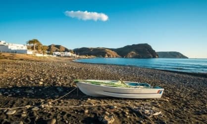
Las Negras was formerly an exclusively fishing village, but nowadays it shares this activity with tourism.
Las Negras owes its name to the mountain near the town, "Cerro Negro"; an impressive rock formation with the appearance of a dark colored lava tongue, from which due to erosion, black stones have been scattered on the beaches of the town to make the landscape this dramatic color.
Its main natural attraction is its beach.
The village has various accommodation options and there is the possibility of camping in a special area set up for it.
Fernan Perez
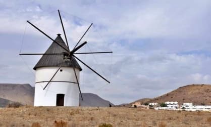
It is one of the few inland locations within the Cabo de Gata-Nijar Natural Park. Fernan Perez still retains the rural charm of times gone by, with its white houses, its church and its inhabitants who live mainly from agriculture and livestock.
It is one of the oldest towns in the area, created in the mid-18th century thanks to a generalized improvement of the crops. It is worth highlighting the “Cortijo Huerta Grande" Aqueduct, formed by 42 arches and with a length of 170 meters.
It is one of the oldest towns in the area, created in the mid-18th century thanks to a generalized improvement of the crops. It is worth highlighting the “Cortijo Huerta Grande" Aqueduct, formed by 42 arches and with a length of 170 meters.
Some inhabitants of the place maintain the custom of practicing cultivation on a smaller scale in traditional gardens. Although it does not have special facilities for tourism, its rural setting, its rich history and the tranquillity of the village are ideal for those who prefer a peaceful environment.
Agua Amarga

The name of Agua Amarga comes from the Arabic Al-hawan, which means location of water.
It is one of the most beautiful villages in the park, with a very small population center, although in summer it increases considerably.
The Agua Amarga Beach, perfectly aligned with the town, creates a fantastic combination in terms of accessibility and views.
It is one of the most beautiful villages in the park, with a very small population center, although in summer it increases considerably.
The Agua Amarga Beach, perfectly aligned with the town, creates a fantastic combination in terms of accessibility and views.
This coastal village has traditionally been dedicated to fishing as the main economic activity, although its beaches have allowed the development of tourism to a considerable degree.
In its surroundings are hidden coves surrounded by cliffs, ideal for those seeking quieter and more secluded places. On the hills surrounding the village, buildings of unique architecture rise, from which one has a wonderful view of the coast and the rock formations around it.


